GPS Excavator: 2D vs 3D Systems Explained
When you are renovating your home, cutting into a driveway, installing footings, or levelling a block before building, understanding how a GPS excavator works can make a significant difference to the outcome. Modern earthworks are no longer guided purely by string lines and manual measurements. Instead, machine guidance technology allows operators to dig and grade with impressive precision. If you are engaging contractors for site preparation, it is helpful to know the difference between 2D and 3D GPS systems. By understanding how these systems control depth, levels and contours, you can better appreciate the accuracy of the work being done on your property and make more informed decisions about the equipment and technology being used on your project.
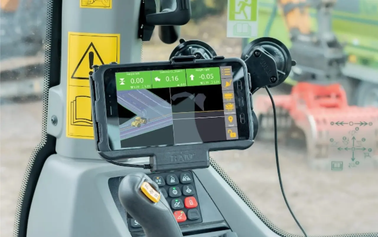
What does a GPS excavator system do?
At its core, a gps excavator system provides the operator with real-time information about the position of the bucket relative to a target level or design. Instead of relying solely on string lines, pegs, or constant spot checks, the operator can see exactly how deep to dig or how high to build up material.
These systems improve consistency and reduce human error, particularly on repetitive or large-scale earthmoving tasks. The main difference between 2D and 3D systems lies in how that positional information is generated and displayed.
Understanding 2D excavator systems
A 2D system is the simpler of the two options. It typically measures the position of the excavator bucket relative to a fixed reference point, such as the machine itself or a laser level. Sensors are mounted on the boom, stick, and bucket to calculate depth and slope.
Because a 2D system does not rely on satellite positioning, it does not know where the machine is on the site. Instead, it focuses on vertical accuracy and basic slope control. This makes it ideal for tasks where depth is the primary concern.
Common applications for 2D systems include trenching to a set depth, digging footings, and working off a laser benchmark. For operators who perform similar tasks day in and day out, a 2D setup can deliver significant efficiency gains without adding complexity.
Benefits of 2D systems
One of the biggest advantages of 2D systems is their simplicity. They are generally faster to install, easier to learn, and more affordable than 3D alternatives. Operators can often be trained in a short time, allowing them to start seeing benefits almost immediately.
2D systems are also reliable in environments where GPS signals may be inconsistent, such as near tall buildings or in heavily treed areas. Because they do not rely on satellites, they can maintain accuracy as long as the reference point remains stable.
For smaller contractors or those new to machine guidance, a 2D system can be an excellent entry point into the world of gps excavator technology.
What is a 3D excavator system?
A 3D system adds another layer of capability by using GPS or GNSS satellites to track the exact position of the machine on the site. In addition to sensors on the boom and bucket, antennas are mounted on the excavator to determine horizontal and vertical position in real time.
With a 3D system, the operator works from a digital terrain model loaded into the display. This allows the machine to follow complex designs, varying depths, and multiple slopes across an entire site without the need for physical reference points.
3D systems are commonly used on large or complex projects such as road construction, bulk earthworks, and commercial developments where accuracy must be maintained across wide areas.
Advantages of 3D systems
The biggest benefit of a 3D system is versatility. Because it understands the full design of the site, it can guide the operator through complex shapes and changing levels with minimal manual input. This significantly reduces the need for survey stakes and repeated checks.
A 3D gps excavator setup also enables better coordination across multiple machines. When all operators are working from the same digital model, consistency improves and errors are easier to avoid. This can lead to faster project completion and reduced material waste.
Over time, the productivity gains from a 3D system can outweigh the higher upfront cost, particularly on large or ongoing projects.
Cost and complexity considerations
While 3D systems offer advanced functionality, they also come with higher costs and increased complexity. Initial setup requires accurate site models, and operators may need more training to fully utilise the system’s features.
Maintenance and support should also be considered. Software updates, model management, and occasional recalibration are part of owning a 3D system. For some businesses, this additional overhead is a worthwhile trade-off. For others, it may be more than is necessary.
In contrast, 2D systems have fewer ongoing requirements and are often seen as a more straightforward, low-maintenance solution.
Choosing the right system for your work
The choice between 2D and 3D ultimately depends on the type of projects you undertake. If your work involves consistent depths, simple slopes, and smaller sites, a 2D system may deliver everything you need. It provides the core benefits of gps excavator technology without unnecessary extras.
If you regularly handle complex designs, large-scale earthworks, or projects where survey control is critical, a 3D system is likely the better long-term investment. Its ability to work directly from digital models can transform productivity and accuracy across the entire site.
Making an informed decision
Both 2D and 3D systems have a place in modern construction. The key is matching the technology to your workflow, not the other way around. By understanding how each system works and where it excels, you can choose a gps excavator solution that improves efficiency, reduces rework, and supports sustainable growth for your business.